Readying a generation of techno-agriculturalists
New technologies rushing into the field of agriculture have changed the profile of agro-scientists worldwide. Competitive farmers require countless new competencies and abilities. To meet this demand, EARTH University created the Center for Geomatics and Remote Detection (CGDR, for its initials in Spanish), which has trained around 400 students in the practical and theoretical use of drones.

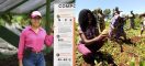
Students and Professor Carlomagno Soto
Thanks to the University’s ongoing evaluation of its education model, close relationships with alumni, and keen understanding of the agricultural sector’s realities, EARTH has incorporated these in-demand skills into the curricula of its changemakers.
“We want our students to have new abilities and differentiated competencies in this tech area,” explains Víctor Hugo Morales, EARTH professor of tropical silviculture and CGDR co-coordinator. Students have demonstrated great interest in the subject, which led to the creation of a core third-year course and a fourth-year elective around drones. These courses allow for greater specialization in data analysis and geostatistics.
“In four years, students learn this technology’s use, converting themselves into generation 3.0, being that they are no longer like the conventional students who can only specialize in routine agricultural activities,” Morales says. “Rather, they think about and employ technology to improve processes.”
EARTH alum Orlando Solís (’18, El Salvador) is a clear example of CGDR’s impact. “The experience of learning about these technologies at EARTH enabled me to specialize in them. In El Salvador, it is difficult to find professionals who know their application in agriculture,” says Orlando, coordinator of Drontek – a business that offers diverse drone-based services. “Thanks to EARTH, I have been able to offer added value.”
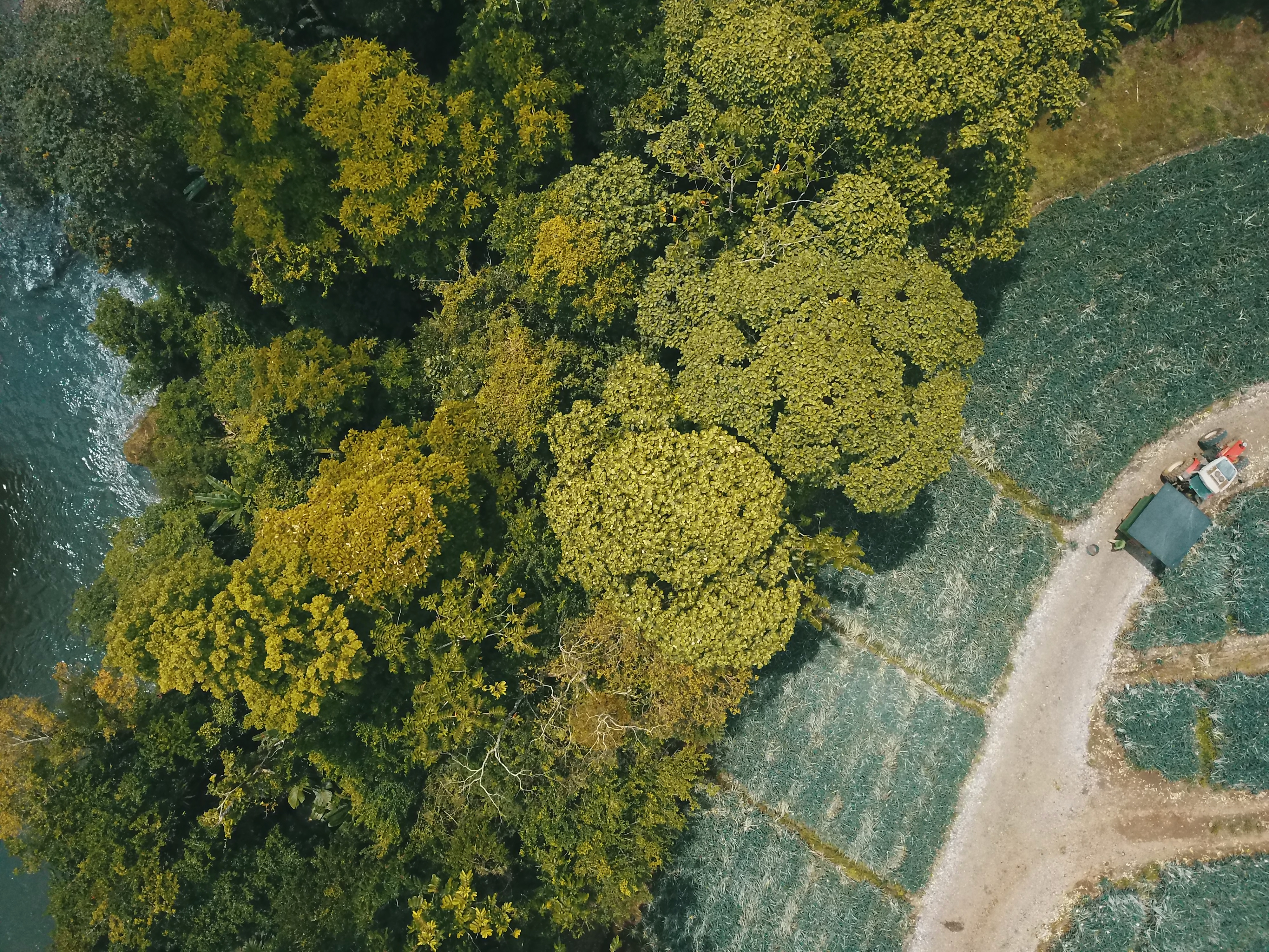
Picture taken with an unmanned aerial vehicle
The use of drones or UAVs (unmanned aerial vehicles) in agricultural management has transformed the sector, becoming an indispensable data-collection tool for farmers and consultants. Previously, capturing images and information about large swaths of land required the use of satellites or airplanes. Such activities required a great investment of time and money because they were neither easily accessible nor efficient. Today, great expanses can be mapped with simply a drone – and produce richly useful data in minutes.
“Drones are used in different disciplines of agronomy – such as surveying to calculate plot measurements, topography to yield irrigation and drainage recommendations, and crop analyses,” explains Carlomagno Soto, professor of spatial-information operation and member of the CGDR team.
Drone uses vary depending on the characteristics of each device. The more common varieties feature natural-color sensors, which capture retina-quality images as well as perform topographic and photogrammetric measurements and analyses.
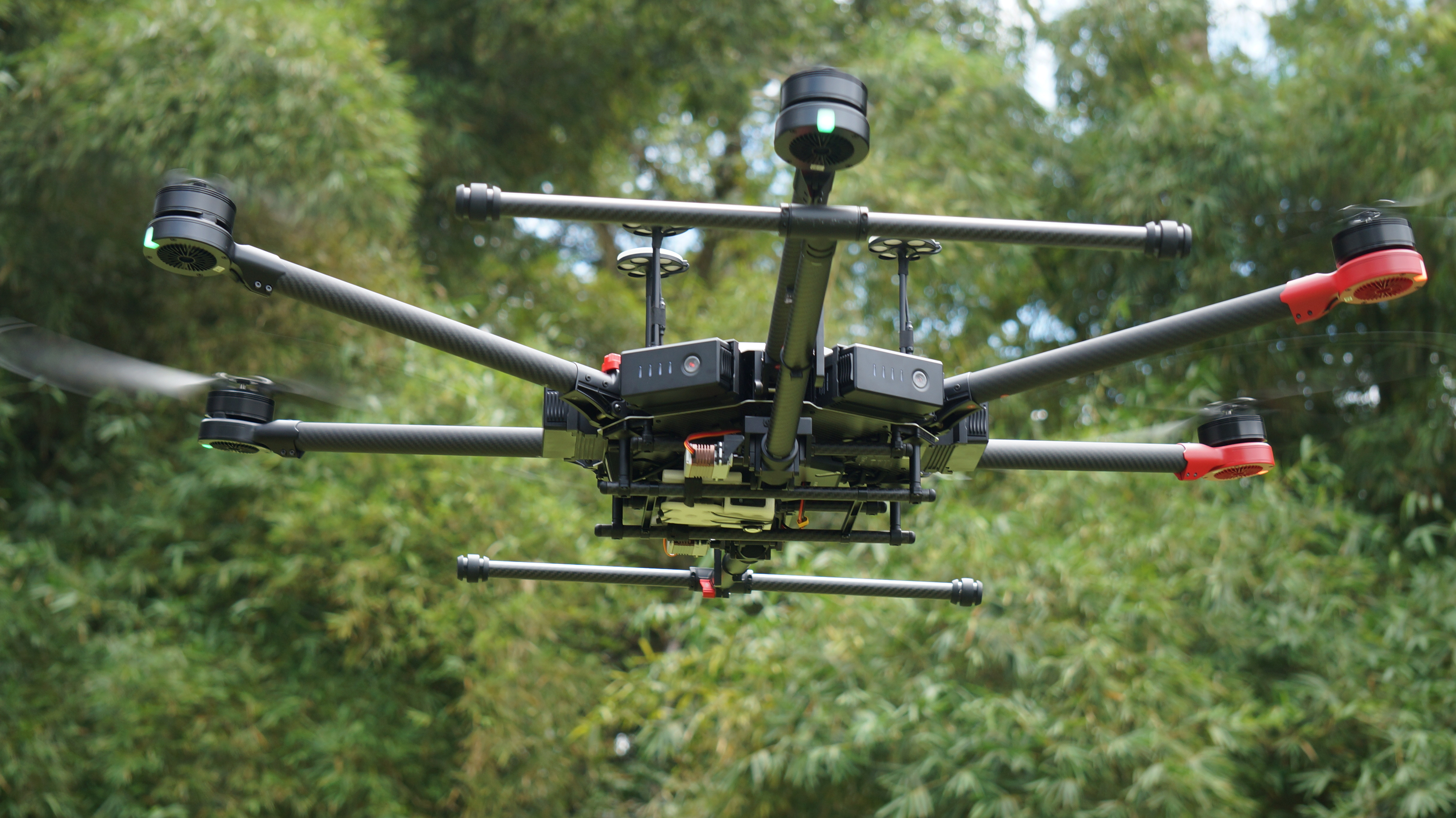
Drone used at EARTH
There also exist more advanced UAVs with multispectral sensors. The infrared sensor, for example, offers insight into plant stress and structure. Additionally, it facilitates knowledge of pest-vulnerable vegetation as well as forecasts harvests. Drones optimize production processes and lower resource use on farms because they enable the inexpensive study from afar of crops’ nutrient and water needs.
Currently, EARTH maintains a fleet of 12 drones of varying characteristics and purposes. Thanks to the support of organizations such as Katherine John Murphy Foundation and oversight by the academic administration, EARTH students have access to an impressive inventory of UAVs that push their hands-on education toward technology’s cutting edge.

Professor Víctor Hugo Morales (right) and workshop participants at Ecuador
CGDR’s leadership is reaching far and wide, having trained more than 250 people outside campus since its founding. In August, for example, professors Morales and Soto traveled to Ecuador to present workshops to public and private professionals – including several EARTH alumni.
In late October, CGDR will offer a practical-technical course in drone-powered remote detection. For more information, please contact cgdr@earth.ac.cr.